Hi,
I would like to report a bug when I load the fcsv files.
I export landmarks as fcsv files, but when I want to load them in a new slicer windows. I found the value was changed to the opposite value automatically.
For example, these are first two landmarks in the fcsv file.
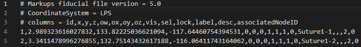
You can see the x value are 2.989 and 3.341.
But when I loaded in slicer, the value was changed to the reverse value -2.989 and -3.341

Does anyone meet the similar bug before? Until now I have not solved this problem.
Best regards,
Chuan